Mount Kilimanjaro Climbing Shira Route
Mount Kilimanjaro Climbing Shira Route
The Shira route is another path that approaches Kilimanjaro from the west, and it is nearly identical to the Lemosho route. In fact, Shira was the original route and Lemosho is the improved variation. While Lemosho starts at Londorossi Gate and treks through the rain forest to Shira 1 Camp, the Shira route bypasses this walk by using a vehicle to transport climbers to Shira Gate, located near the Shira Ridge.
On the first day on the mountain, climbers begin their hike from 11,800 feet (3,600 m) and spend their first night at the same elevation at Simba Camp. Then, the route merges with Lemosho and follows the southern circuit route.
Although Shira is a varied and beautiful route, Lemosho is recommended over Shira due to the relaively high altitude of Shira’s starting point, which is accessed quickly by vehicle. It is possible that climbers will experience some altitude related symptoms on the first day while camping at 11,800 feet.
Arrive anytime at Kilimanjaro International Airport (JRO) or from a Nairobi shuttle transfer, there will be transferred to your hotel in Arusha for your overnight.
Mount Kilimanjaro Climbing Shira Route
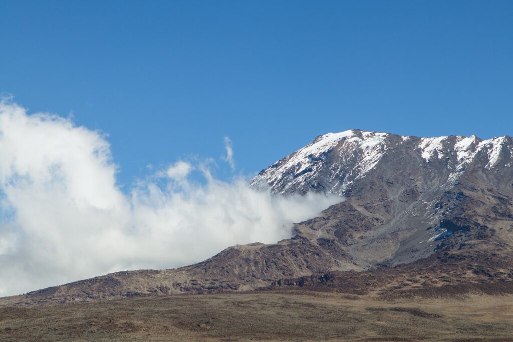
Mount Kilimanjaro is an iconic and majestic stratovolcano situated in northeastern Tanzania, East Africa. It is renowned for being the tallest freestanding mountain in the world and the highest peak on the African continent. Here’s a description of its physical characteristics and features:
- Elevation: The summit of Mount Kilimanjaro, Uhuru Peak, stands at an impressive elevation of 5,895 meters (19,341 feet) above sea level. This towering height makes it a prominent landmark on the African landscape.
- Geology and Formation: Kilimanjaro is a dormant stratovolcano formed by the accumulation of layers of lava, ash, and other volcanic materials over millions of years. Its distinct conical shape is a result of multiple eruptions and subsequent erosion.
- Glaciers and Snow: Despite its location near the equator, Kilimanjaro’s high altitude has allowed it to support several glaciers and a permanent ice cap. However, due to climate change, these ice formations have been receding in recent decades.
- Ecological Zones: The mountain’s slopes are characterized by distinct ecological zones as you ascend, each with its own unique flora and fauna. These zones include the cultivated foothills, rainforest, moorland, alpine desert, and the arctic summit.
- Biodiversity: Kilimanjaro is home to a diverse array of plant and animal species adapted to its varying altitudes. The lower slopes feature lush rainforests with colobus monkeys, blue monkeys, and a variety of bird species. As you climb higher, you’ll encounter unique high-altitude plants like giant groundsel and lobelias.
- Climbing Routes: The mountain offers several different climbing routes, each providing a distinct experience in terms of scenery, difficulty, and acclimatization. These routes vary in length and can take anywhere from 5 to 9 days to complete, depending on the chosen path.
- Cultural Significance: Kilimanjaro holds cultural significance for the local Chagga people, who have lived in the region for centuries. The mountain plays a role in their myths, rituals, and agricultural practices.
- Tourism: Kilimanjaro attracts climbers, trekkers, and adventure enthusiasts from around the world who seek to conquer its summit. The challenge of reaching Uhuru Peak and the breathtaking panoramic views from the top are major draws.
- Conservation: The mountain and its surrounding area are protected as Kilimanjaro National Park, a UNESCO World Heritage Site. Efforts are made to preserve its natural beauty, biodiversity, and cultural heritage.
- Changing Landscape: Climate change has had a noticeable impact on Kilimanjaro, causing the reduction of its glaciers and altering its ecosystems. Scientists and conservationists are studying these changes and their implications for the mountain’s future.
Mount Kilimanjaro stands as a testament to the beauty and diversity of the natural world, attracting adventurers and explorers while highlighting the need for responsible environmental stewardship.
The best months for Climbing Mount Kilimanjaro
Normally April and May are the months with long rains and should be avoided.
November is usually short rains but it is not often rains all day.
The best time for climbing mount Kilimanjaro is January to February and September.
July to August can be colder and November to December can be wetter.
January to March is the warmest months, almost clear of clouds each evening and morning.
The success rates with our guides are outstanding compared to the overall success rates for all climbers who attempt to reach the top.
Mount Kilimanjaro Climbing Shira Route
| Destination |
MT KILIMANJARO CLIMBING: SHIRA ROUTE |
| Depature |
Yes Required |
| Departure Time |
|
| Return Time |
|
| Included |
- Quality, waterproof, four-season private mountain sleeping tents:
- Professional, experienced, mountain guides:
- Two nights hotel in Arusha
- All Park fees
- Rescue fees
- All meals while on the Mountain
- Arrival and Departure transfers
- Guides, Porters, cook salaries and park fees
- Large portions of fresh, healthy, nutritious food:
- Clean, purified drinking water:
- Crisis management and safety procedures:
- Fair and ethical treatment of porters:
- Summit Emergency Oxygen:
- Pulse Oximeters:
- Walking Poles:
- Sleeping Mattress:
|
| Excluded |
- Tanzania Visa: $50 per person on arrival
- Personal Expenses (e.g. laundry, telephone, beverages, etc.)
- Meals not listed above
- Optional Tours (short safari after your climb etc)
- Tips and any items of personal nature.
|

No Review
Accommodation0
Transport0
Comfort0
Hospitality0
Food0